
GML — Geography Markup Language
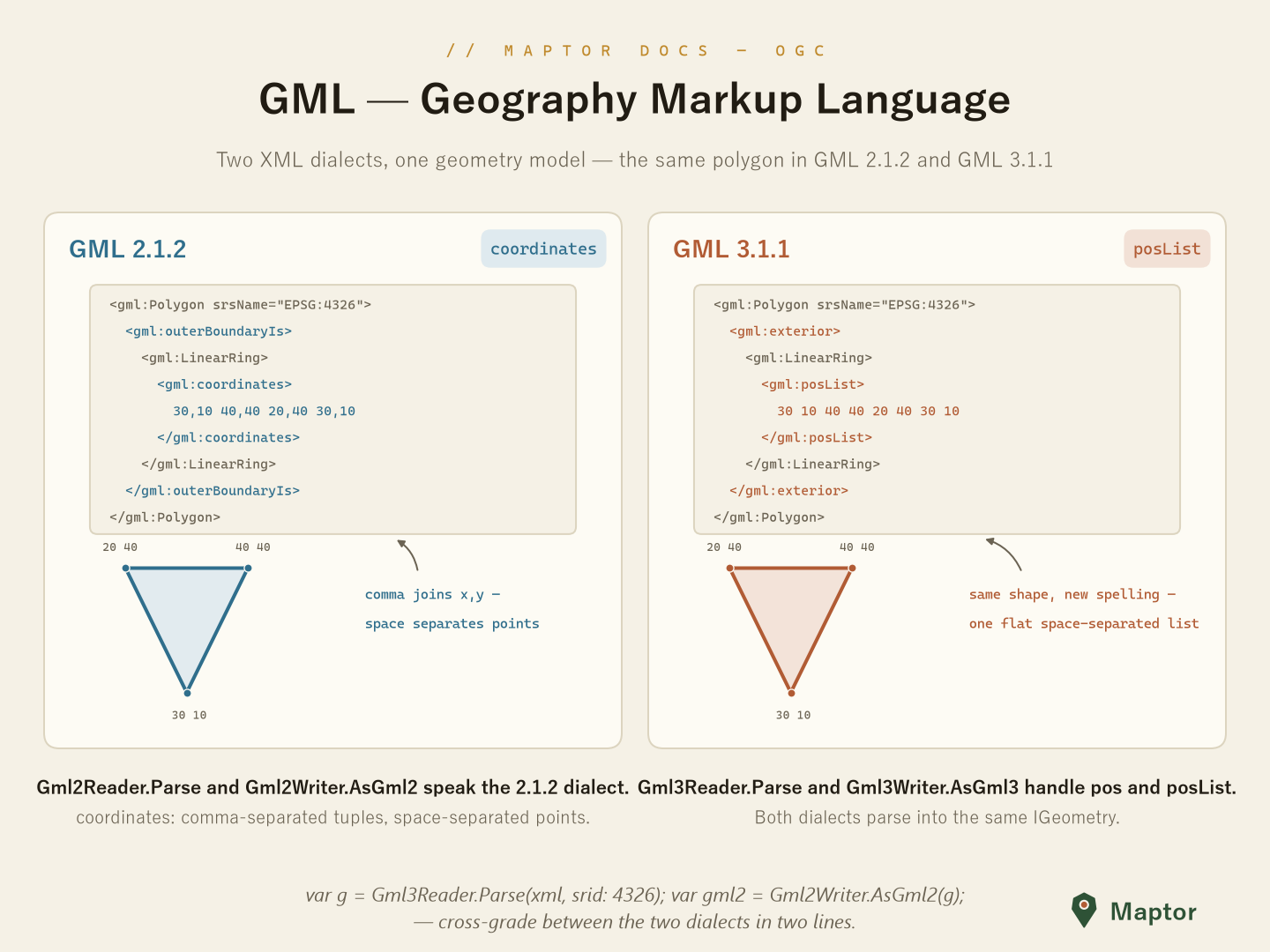
OGC's XML encoding for geometry. This folder speaks both widely deployed dialects — same shapes, different spelling:
| Version | Ring element | Coordinate encoding |
|---|---|---|
| 2.1.2 | <gml:outerBoundaryIs> |
<gml:coordinates> — comma joins x,y; space separates points |
| 3.1.1 | <gml:exterior> |
<gml:pos> / <gml:posList> — one flat space-separated list |
Reading GML
Gml2Reader and Gml3Reader (namespace IRI.Maptor.Core.Ogc.GML) parse a GML fragment into the library's geometry model. Both dialects land in the same IGeometry, so downstream code never cares which version the server spoke.
using IRI.Maptor.Core.Ogc.GML;

var g2 = Gml2Reader.Parse(gml2Xml, srid: 4326);   // IGeometry — e.g. Type: Polygon
var g3 = Gml3Reader.Parse(gml3Xml, srid: 4326);   // same model, 3.1.1 dialect
Writing GML
Gml2Writer.AsGml2 and Gml3Writer.AsGml3 serialize a geometry back out; includeSrid adds the srsName attribute.
string gml2 = Gml2Writer.AsGml2(geometry);                      // <gml:Polygon><gml:outerBoundaryIs>…
string gml3 = Gml3Writer.AsGml3(geometry, includeSrid: true);   // <gml:Polygon srsName="EPSG:4326"><gml:exterior>…
Because both readers produce the same IGeometry, cross-grading between dialects is a read in one and a write in the other:
string downgraded = Gml2Writer.AsGml2(Gml3Reader.Parse(gml3Xml, srid: 4326));
Generated schema models
For schema-level XML work (building documents element by element rather than from geometries), the folders v2.1.2/ and v3.1.1/ carry the generated object models — PointType, LineStringType, PolygonType, MultiPolygonType, CoordinatesType and friends — under the IRI.Maptor.Core.Ogc.GML.v212 and .v313 namespaces.