
این صفحه هنوز ترجمه نشده است؛ نسخهٔ انگلیسی نمایش داده میشود.
TopoJSON
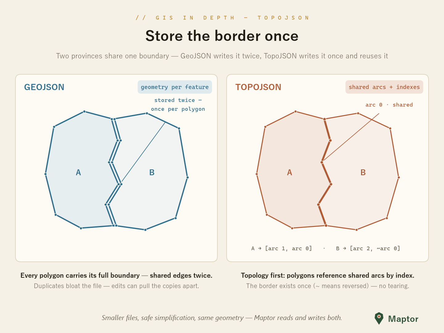
A .NET Standard implementation of TopoJSON — a GeoJSON extension that encodes topology as shared line segments (arcs) to reduce redundancy and file size. Supports reading, writing, and conversion to/from the library's Feature<Point> types.
Supported capabilities
| Capability | Supported |
|---|---|
| Read | Yes — TopoJson.Parse / ReadFromFileAsync, TopoJson.ToFeature |
| Write | Yes — TopoJson.WriteToFileAsync / Serialize, TopoJsonConverter.FromFeatures |
| Quantization | Yes — optional, on write (quantize, quantizationFactor) |
| Z / M coordinates | No — 2D only |
Geometry types: Point, MultiPoint, LineString, MultiLineString, Polygon, MultiPolygon, and GeometryCollection. Feature properties are preserved and read back as .NET values. Writing a list of features produces a single GeometryCollection object (the shape Power BI's Shape Map visual expects).
What is TopoJSON?
Instead of storing each geometry's coordinates independently, TopoJSON stitches geometries together from shared arcs. Shared boundaries are stored once, which typically produces smaller files than the equivalent GeoJSON.
Usage
All types live in IRI.Maptor.Core.Spatial.IO.TopoJson.
Reading
using IRI.Maptor.Core.Spatial.IO.TopoJson;

// From file (async) or from a string
TopoJsonTopology topology = await TopoJson.ReadFromFileAsync("map.topojson");
TopoJsonTopology fromString = TopoJson.Parse(File.ReadAllText("map.topojson"));

// Convert to features (keyed by object name); properties come back as typed .NET values
Dictionary<string, Feature<Point>> features = TopoJson.ToFeature(topology, srid: 4326);
Writing
Writing a list of features groups them into a single GeometryCollection.
using IRI.Maptor.Core.Common.Primitives;
using IRI.Maptor.Core.Spatial.Primitives;

var features = new List<Feature<Point>>();
// ... populate features (each with a Geometry<Point> and an attributes dictionary)

await TopoJson.WriteToFileAsync(
    features,
    "output.topojson",
    quantize: true,
    quantizationFactor: 10000,
    collectionName: "regions");
You can also build a topology yourself and write or serialize it separately:
TopoJsonTopology topology = TopoJsonConverter.FromFeatures(features, quantize: true, quantizationFactor: 10000);

await TopoJson.WriteToFileAsync(topology, "map.topojson");
string json = TopoJson.Serialize(topology, indented: false);
Quantization
Quantization snaps coordinates to an integer grid before delta-encoding arcs, trading precision for size. A higher factor keeps more precision; quantize: false writes exact (rounded to integer) coordinates.
var high = TopoJsonConverter.FromFeatures(features, quantize: true, quantizationFactor: 1_000_000);
var low  = TopoJsonConverter.FromFeatures(features, quantize: true, quantizationFactor: 10_000);
var none = TopoJsonConverter.FromFeatures(features, quantize: false);
Inspecting a topology
var topology = await TopoJson.ReadFromFileAsync("map.topojson");

Console.WriteLine($"Arcs: {topology.Arcs.Count}, Objects: {topology.Objects.Count}");

if (topology.Transform is { } t)
    Console.WriteLine($"Scale: [{t.Scale[0]}, {t.Scale[1]}]  Translate: [{t.Translate[0]}, {t.Translate[1]}]");

if (topology.BBox != null)
    Console.WriteLine($"BBox: [{string.Join(", ", topology.BBox)}]");
Format details
| Aspect | TopoJSON in Maptor |
|---|---|
| Coordinate system | TopoJSON follows GeoJSON's WGS 84 convention but stores positions as (optionally quantized) numbers and carries no CRS field. Maptor uses srid (default 4326) on read and does not reproject. |
| Z / M | 2D only — Z and M are ignored. |
| Polygon rings | Rings are closed on encode (first vertex repeated) and un-closed on decode. Winding is preserved as-is; the TopoJSON exterior-CW / hole-CCW convention is not enforced. |
| Serialization | System.Text.Json. Deserialize: TopoJson.Parse, TopoJson.ReadFromFileAsync. Serialize: TopoJson.Serialize, TopoJson.WriteToFileAsync. |
| Specification | TopoJSON Specification |
Limitations
- Arcs use delta encoding; negative arc indices indicate a reversed direction. Points and MultiPoints are stored as absolute coordinates (no arcs).
- Quantization is lossy; without quantization, coordinates are rounded to integers when no transform is applied.
- Only 2D coordinates are handled —
ZandMare ignored. - Encoding accepts
Feature<Point>collections; encoding a top-levelGeometryCollectiongeometry is not supported. - Arc deduplication matches arcs by endpoints and point count rather than performing full topological shared-arc extraction.